Current projects

Top down – bottom up is part of an ongoing process of experimental research, in which new possibilities of rethinking the territory are explored through cartography and public space. Motivated by transforming and reformulating the reality of the territory through the imaginary.
As Foucault declared, the territory – beyond being an object – is an action over which control is exercised. It was, and is, constructed from exercises of power by way of the physical, the symbolic and the intangible, practices constantly used in processes of conquest and colonialization. They have imposed on us a unique way of world representation, of travelling it and understanding it. Cities have developed by controlled paths based on political and patriarchal interests.
Within this context where capitalism reigns – only interested in the present, the immediate, mass consumerist and market circulation – much in the same way that globalising strategies use territory as a mechanism of domination and speculation. Consequently proliferating a series of disjointed, decontextualized, disconnected or forgotten places in the urban landscape, thusly causing industrial, social, and cultural precariousness and creating a system that exercises supremacy and prevents any transformation of hope for change outside of that order.
Increasingly alienated and immersed in the impulsive world of digitisation, social networks and mobility applications, (Google Maps, Waze, Bing etc), a condition has been triggered in us, in which the control systems have caused an inability to imagine, to construct subjectivities, and for us to lose our individual autonomy. Therefore, making critical thinking impossible, in front of a paranoid co-dependent state, characterized by anxiety and collective alienation; compliant to a “ society of the virtual spectacle» and the «mainstream».
In this context of accelerated changes, this state between fiction and the reality of the environment we find ourselves in, there is a heightened need to draw other narratives that can stimulate our imagination.
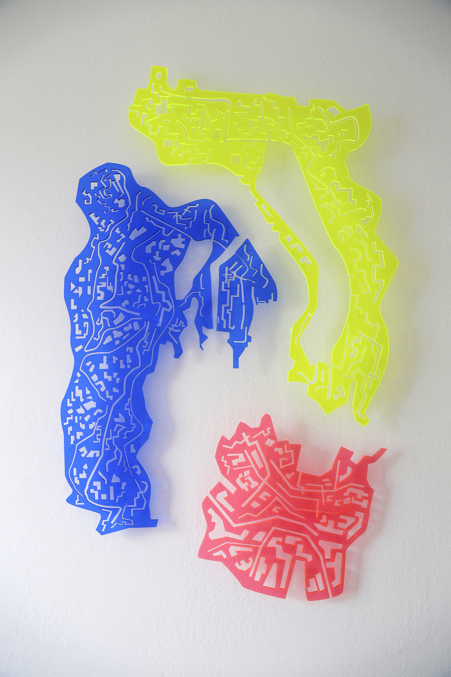
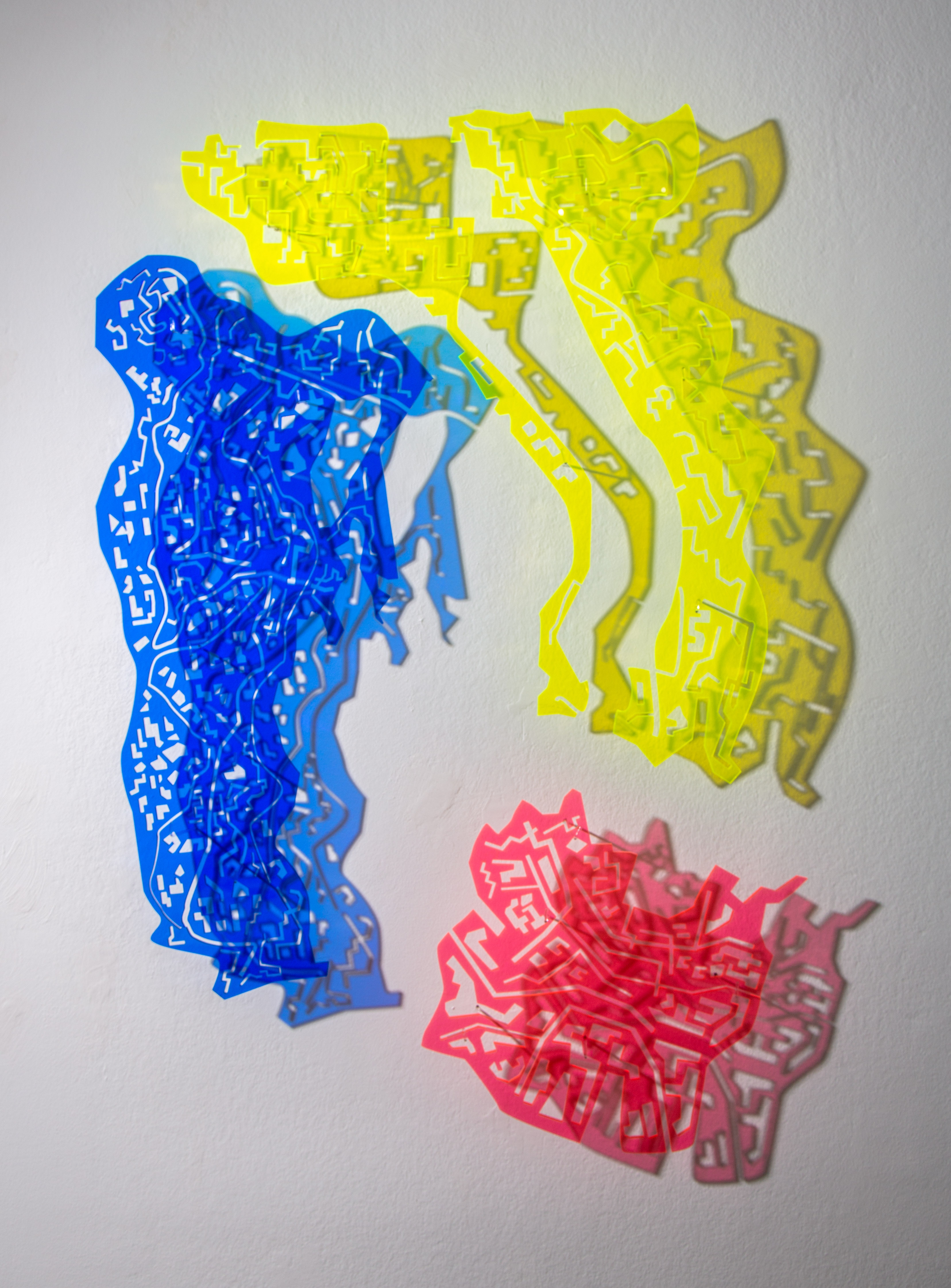
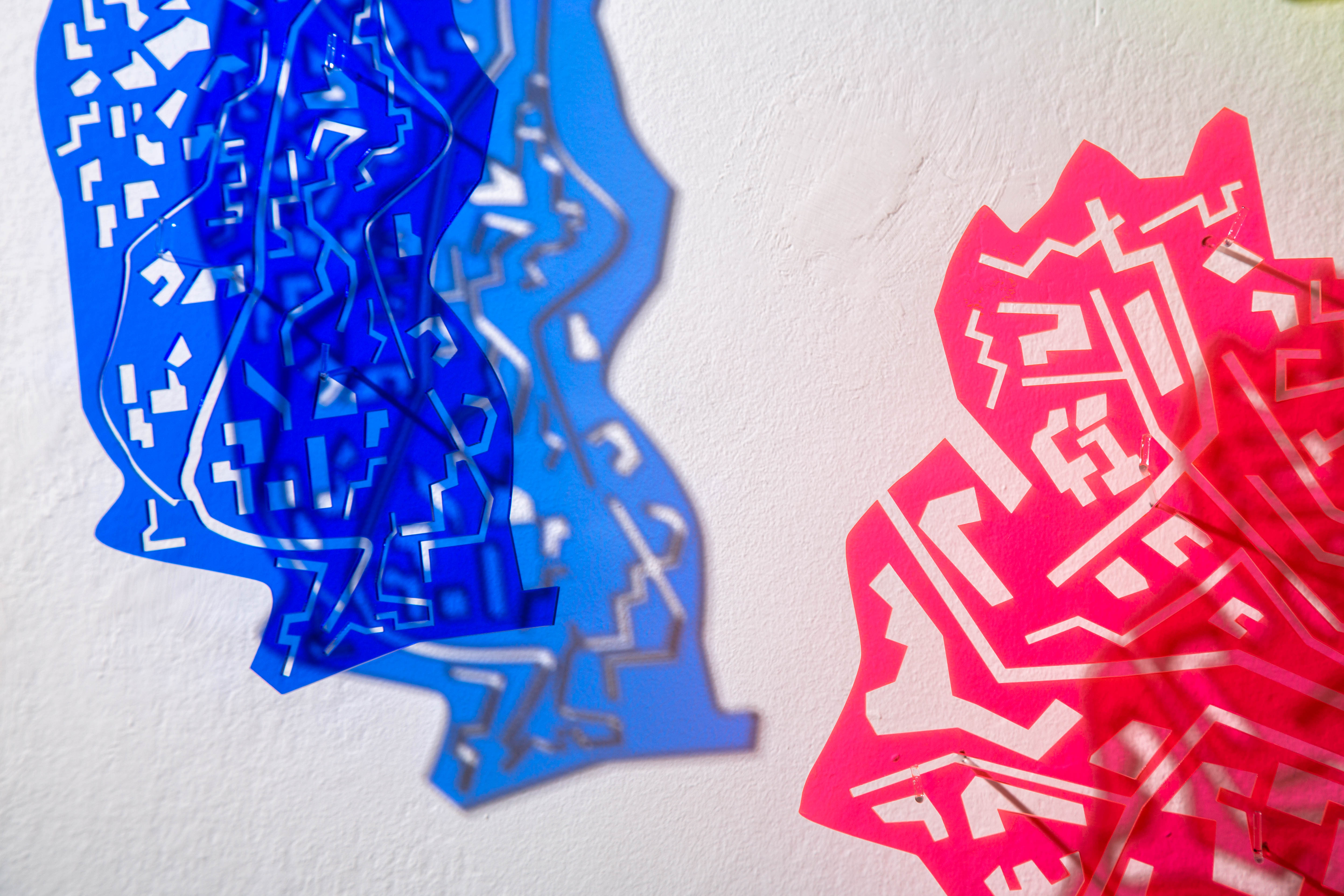
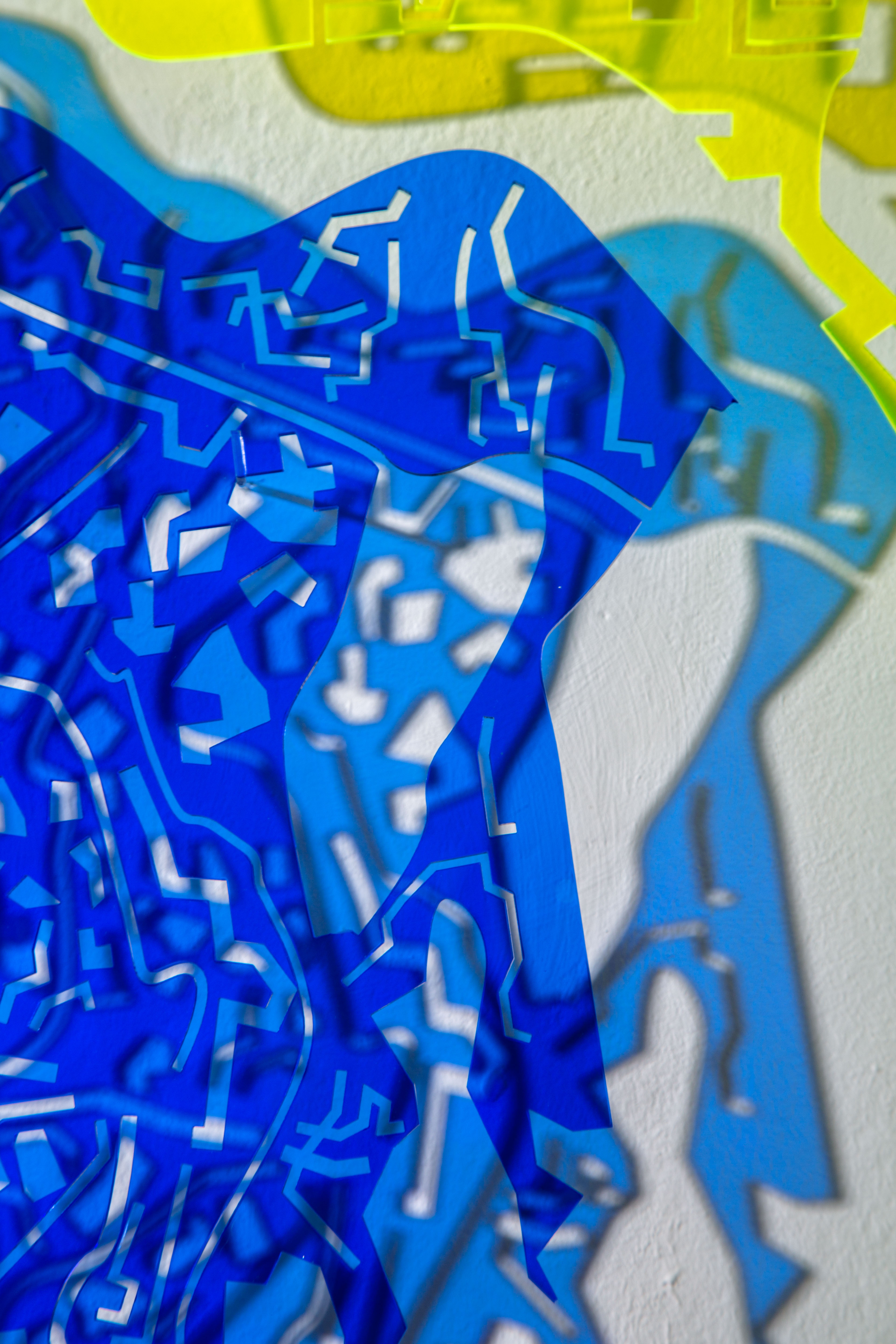
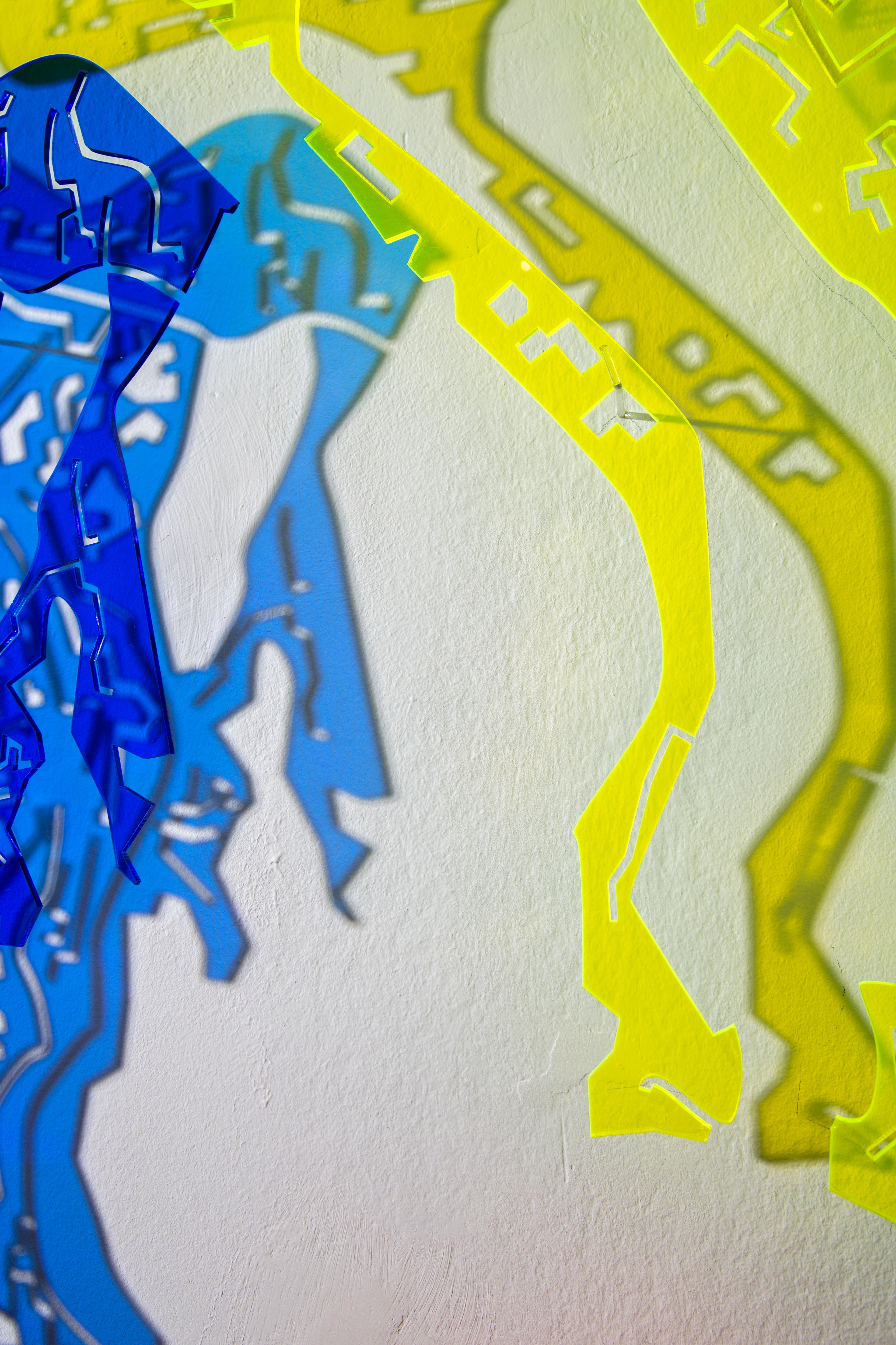
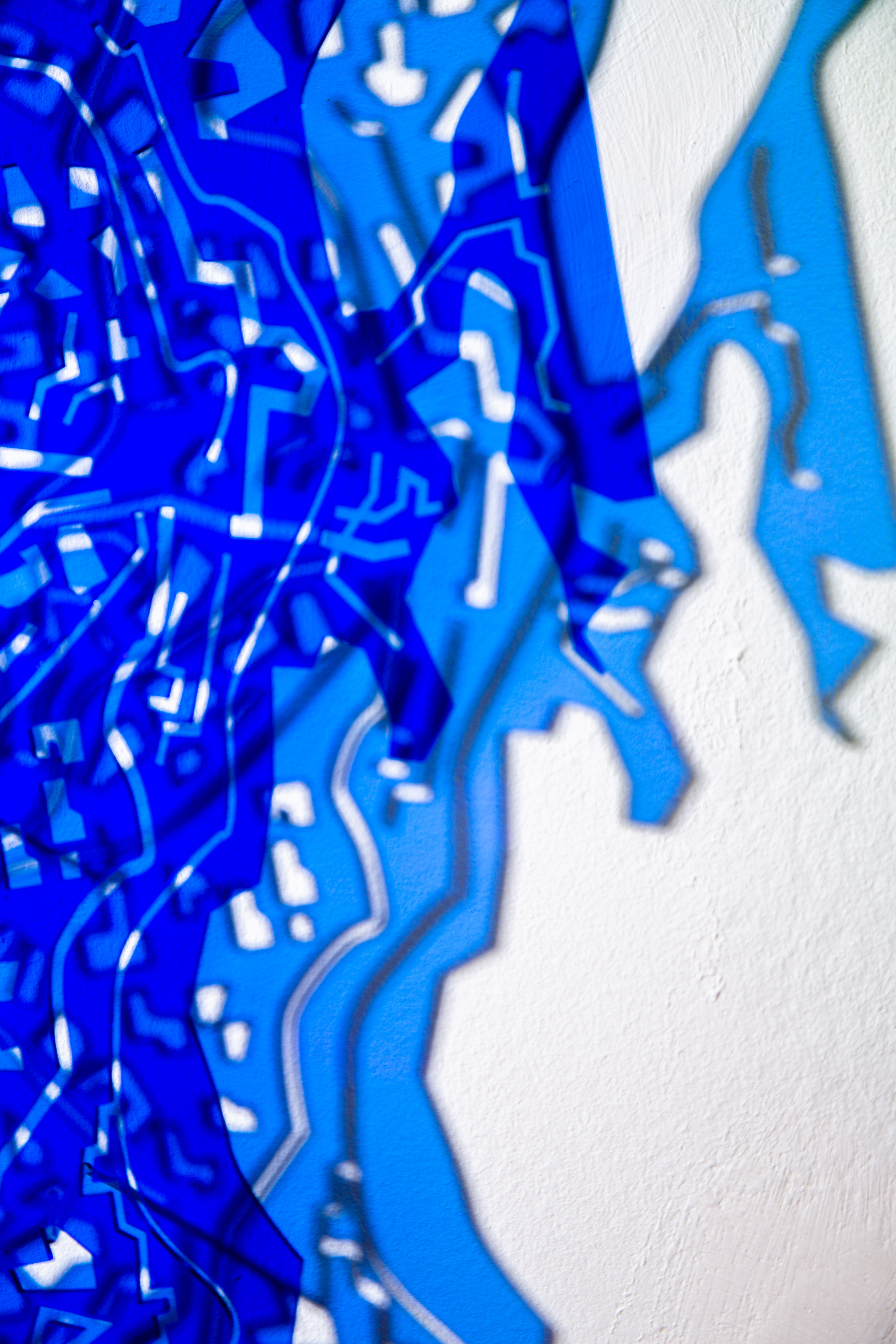
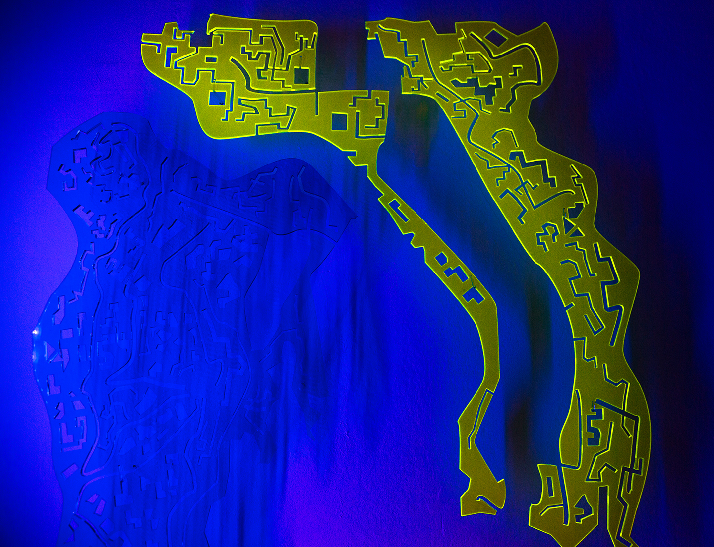
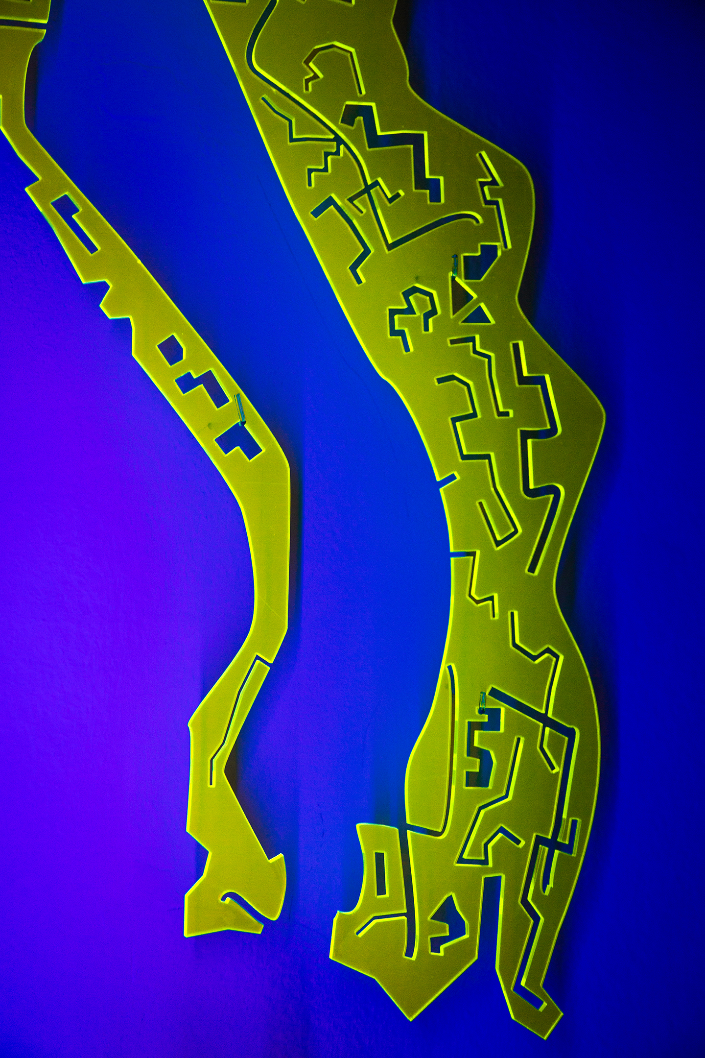
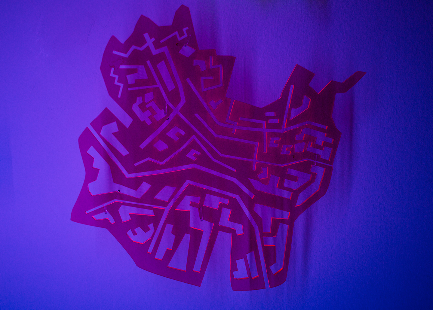
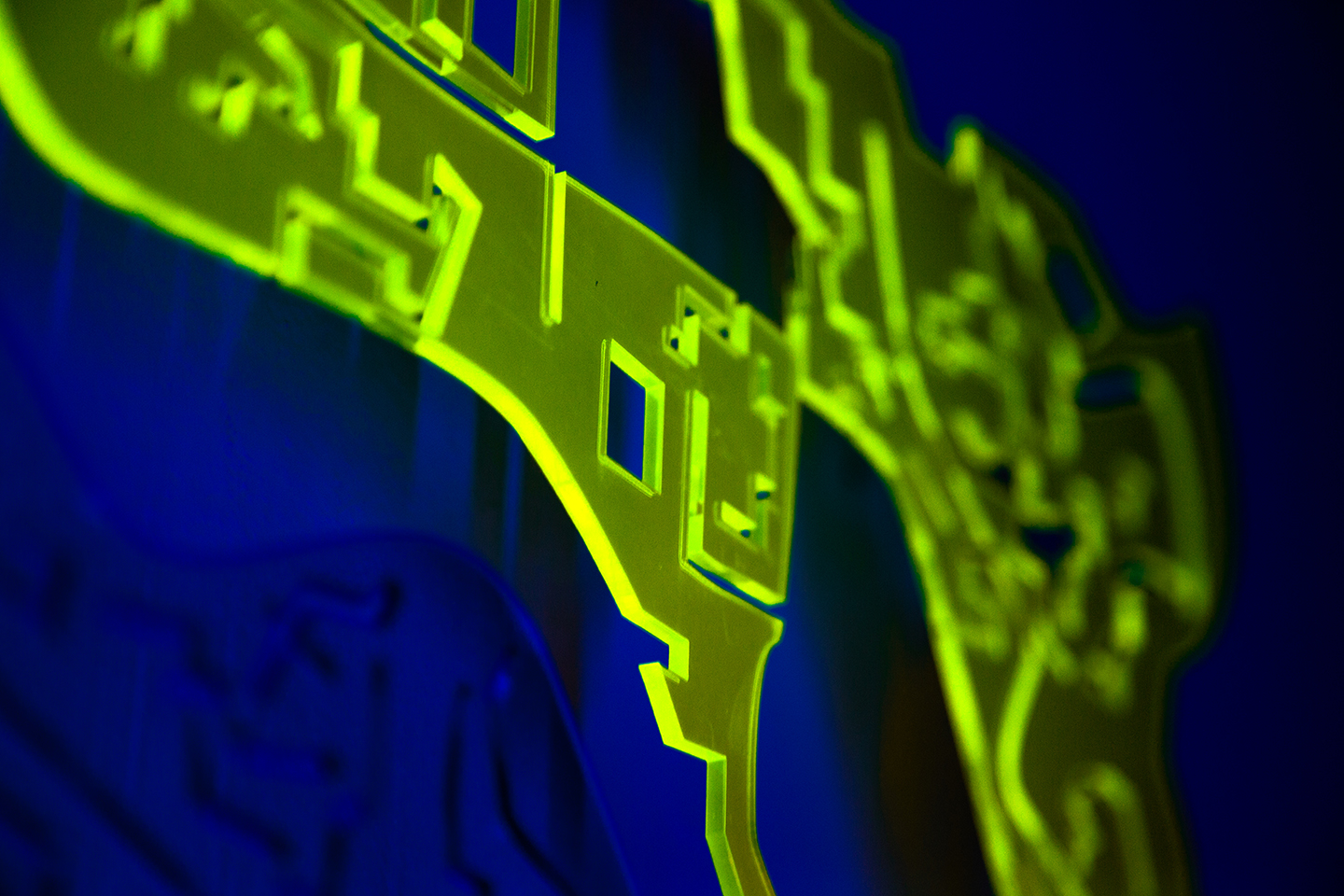
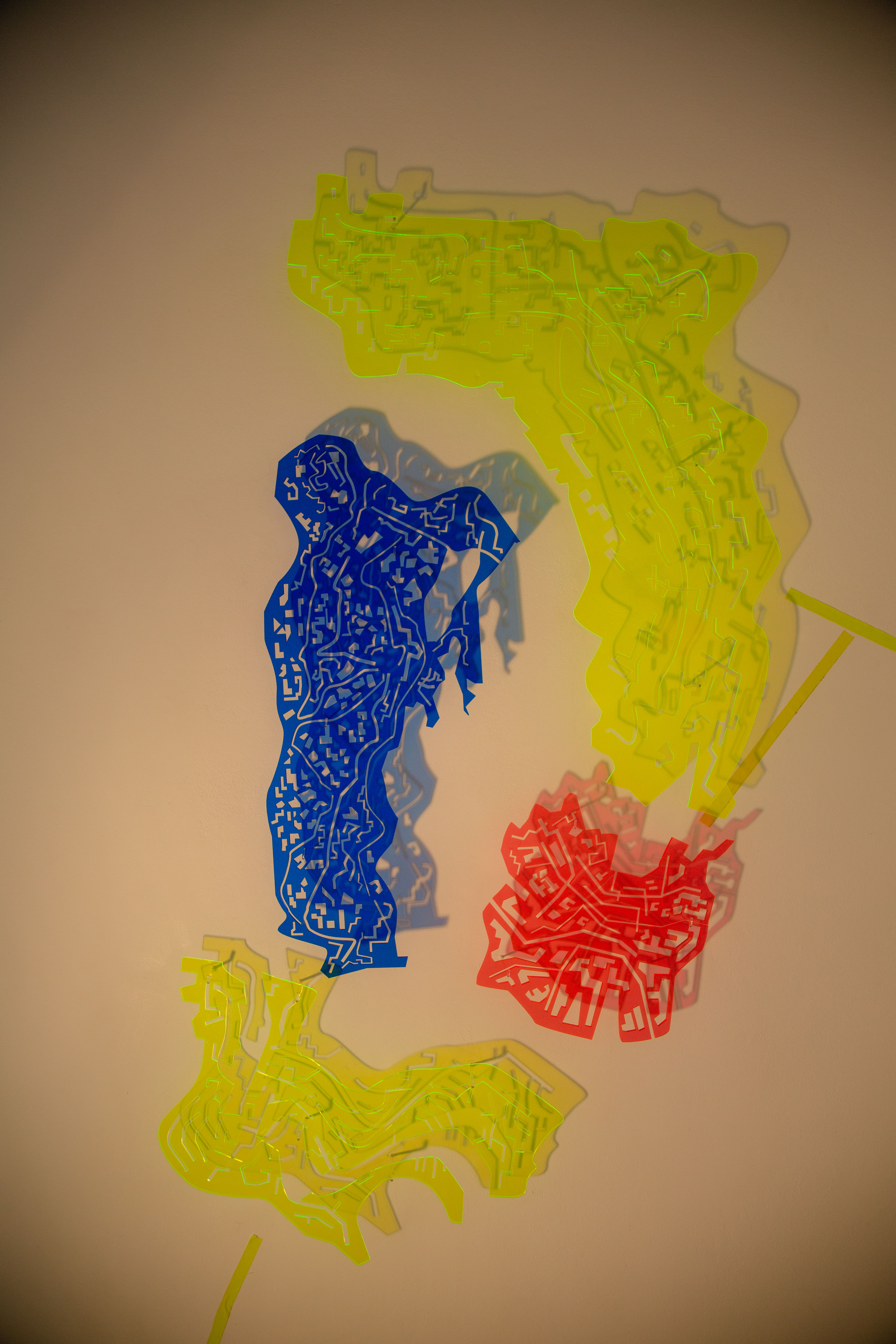
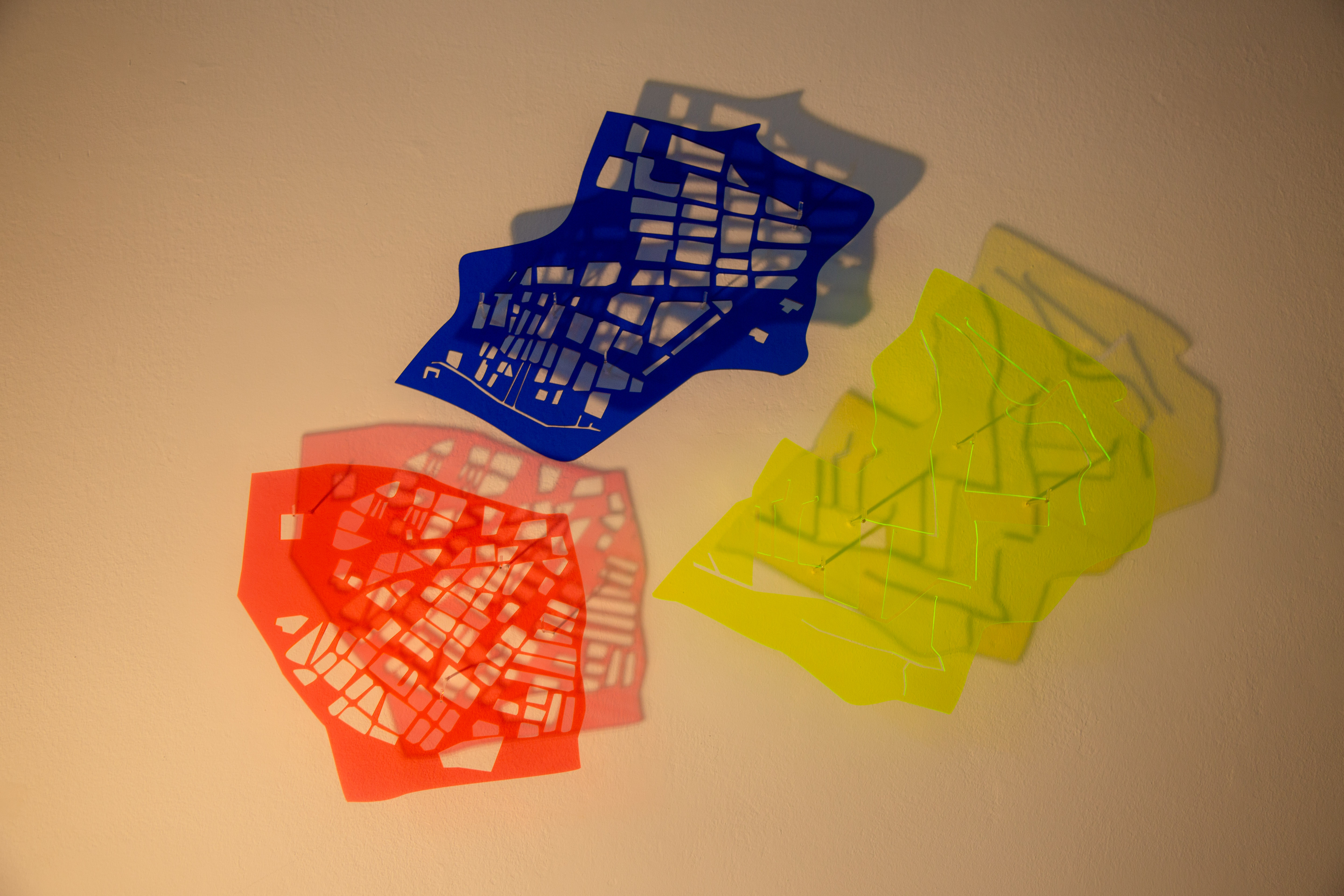
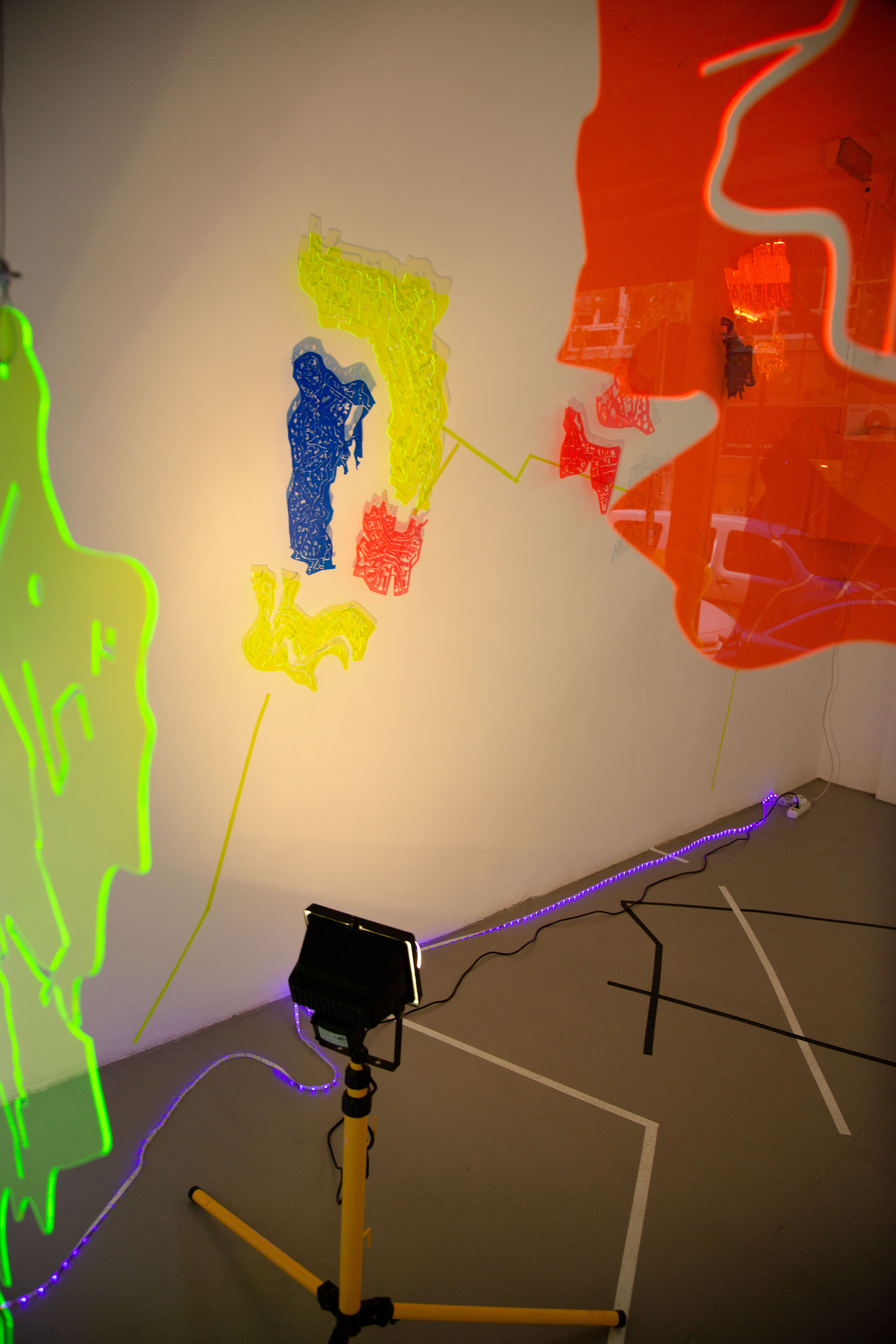
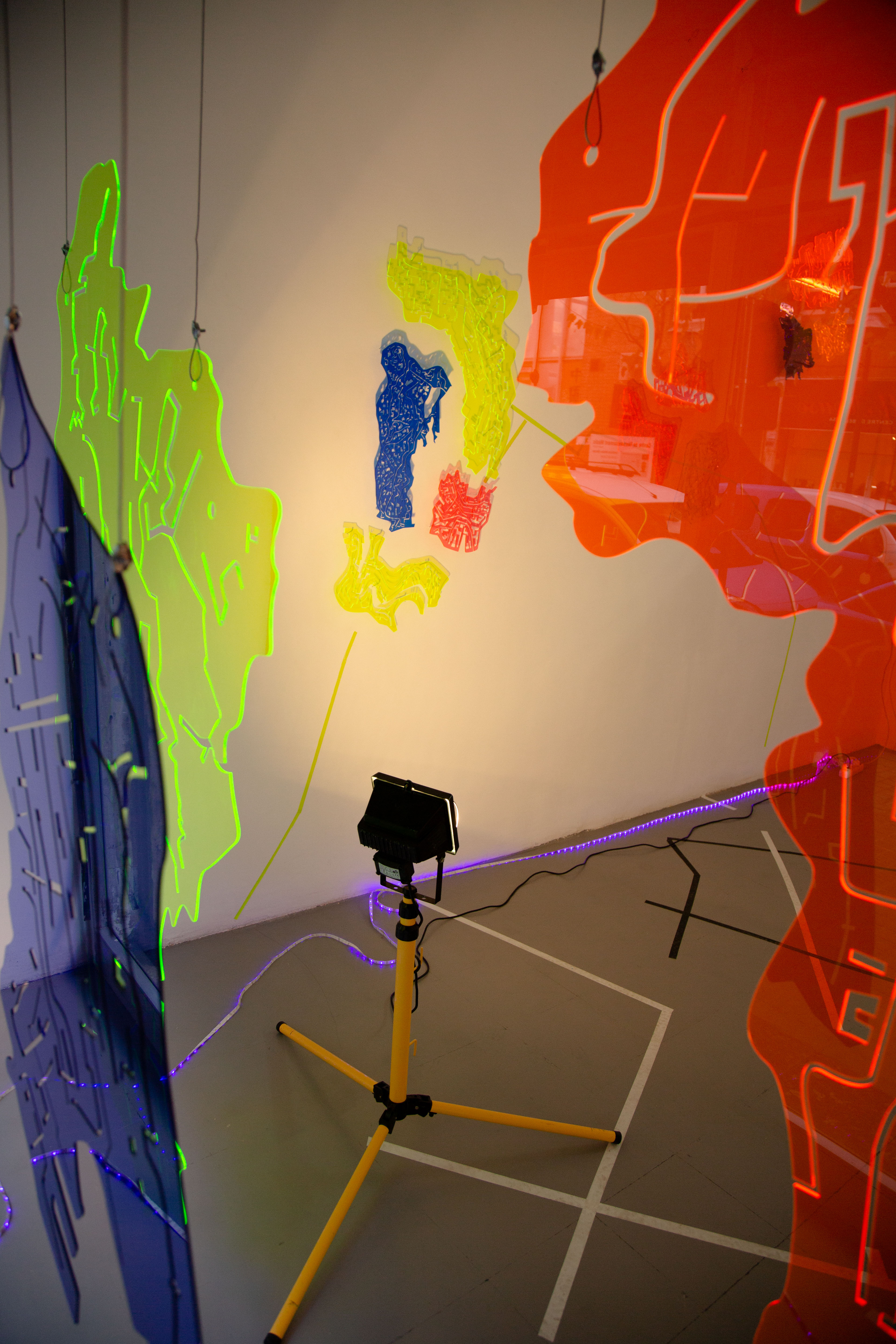
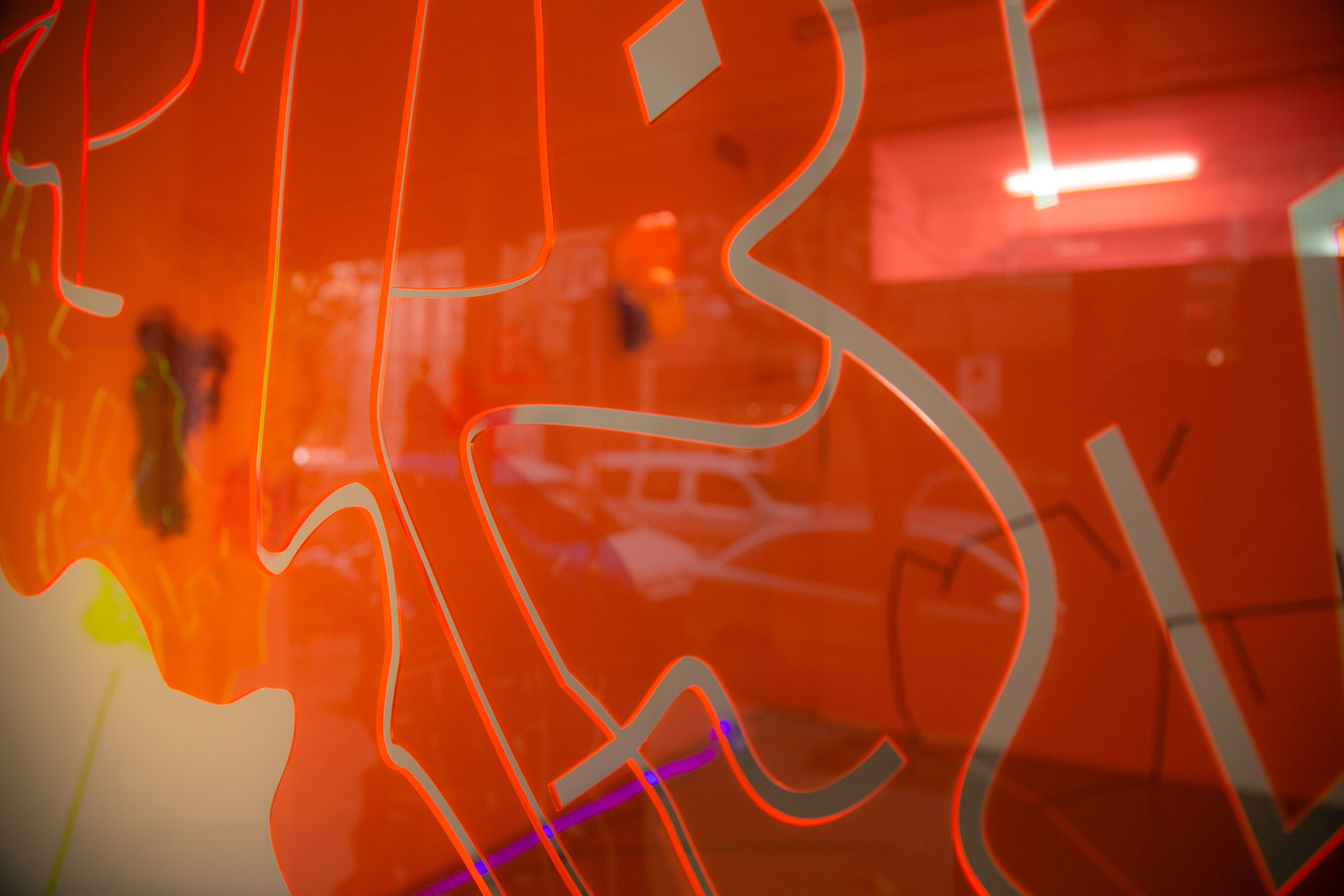
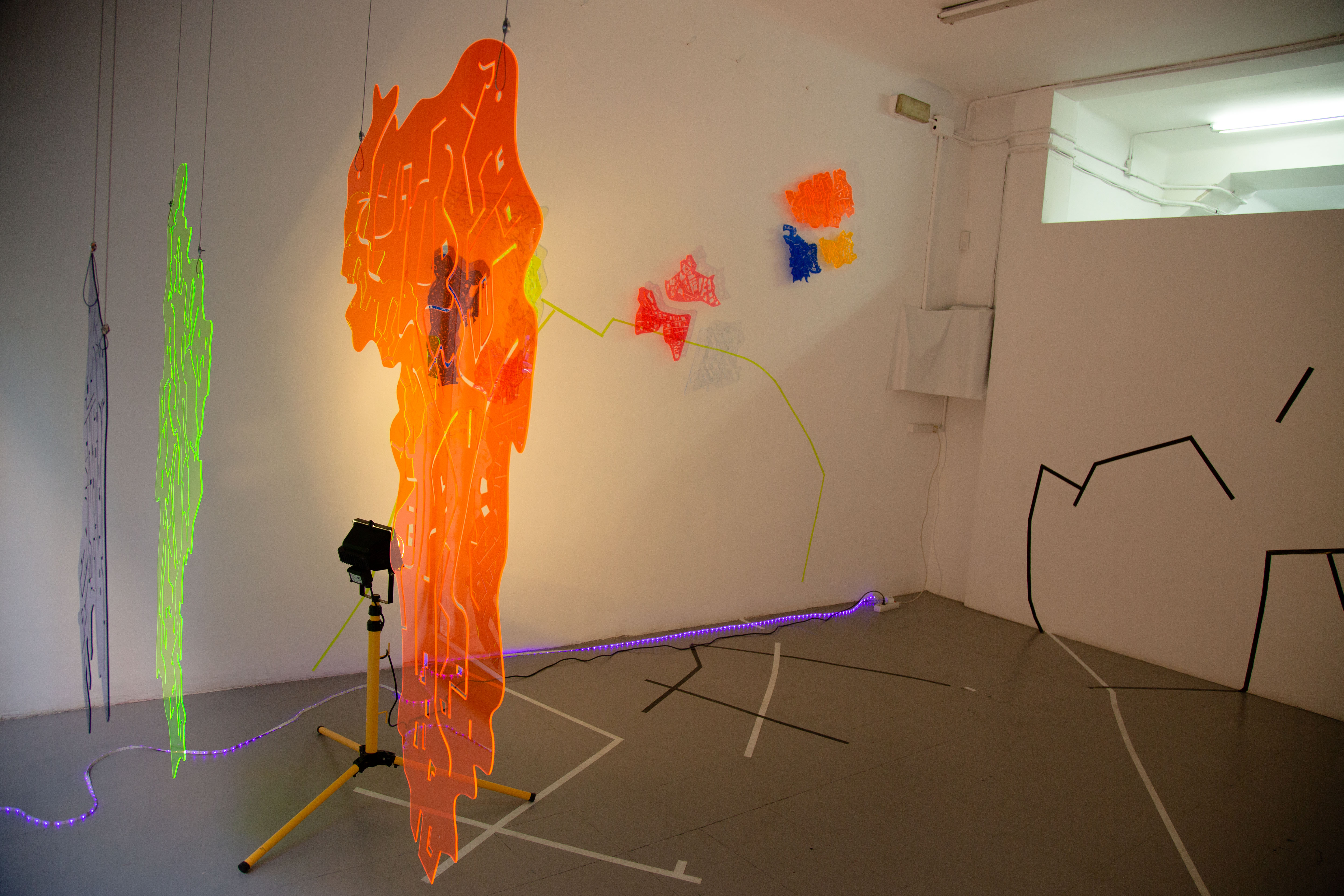
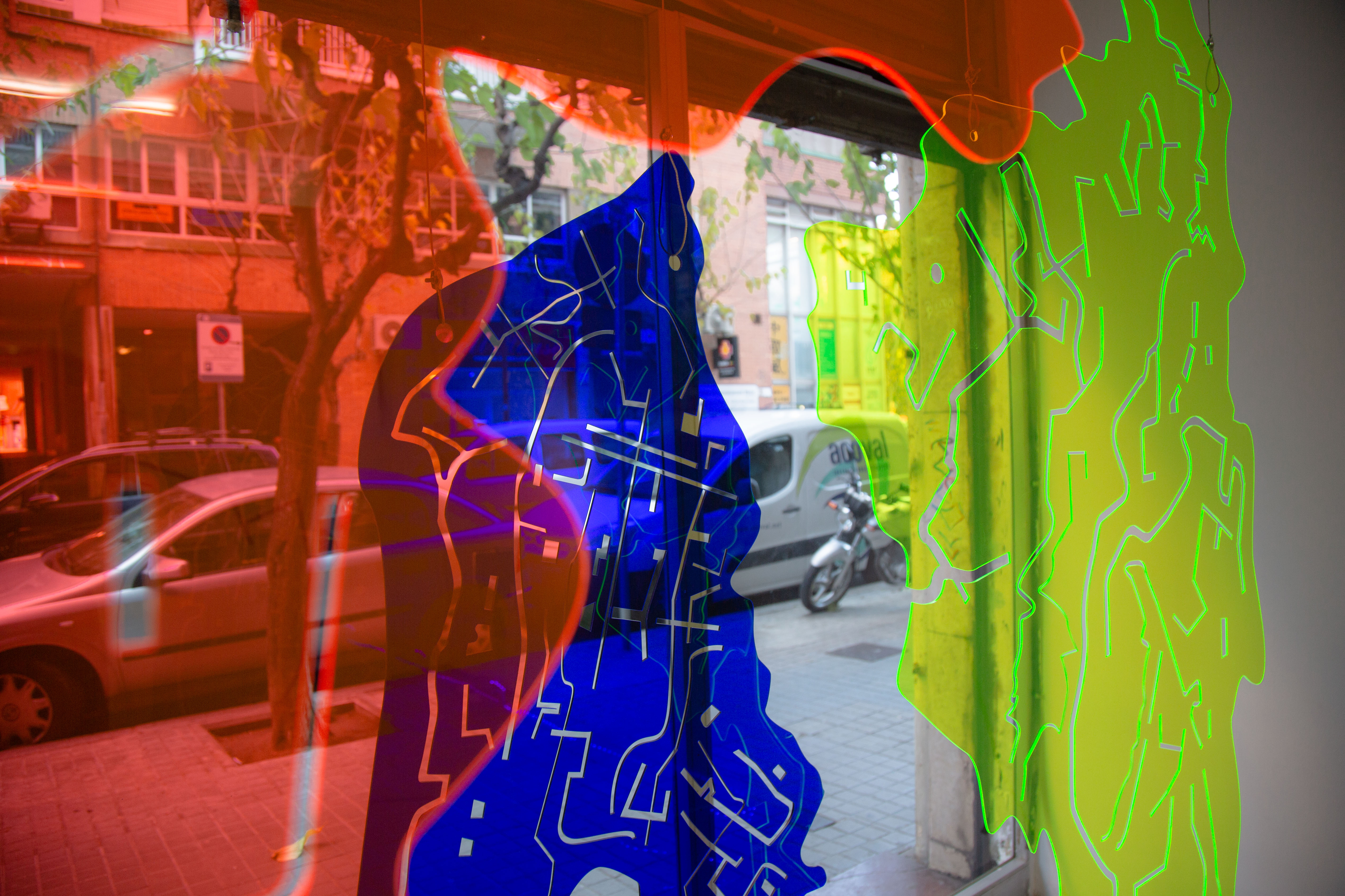
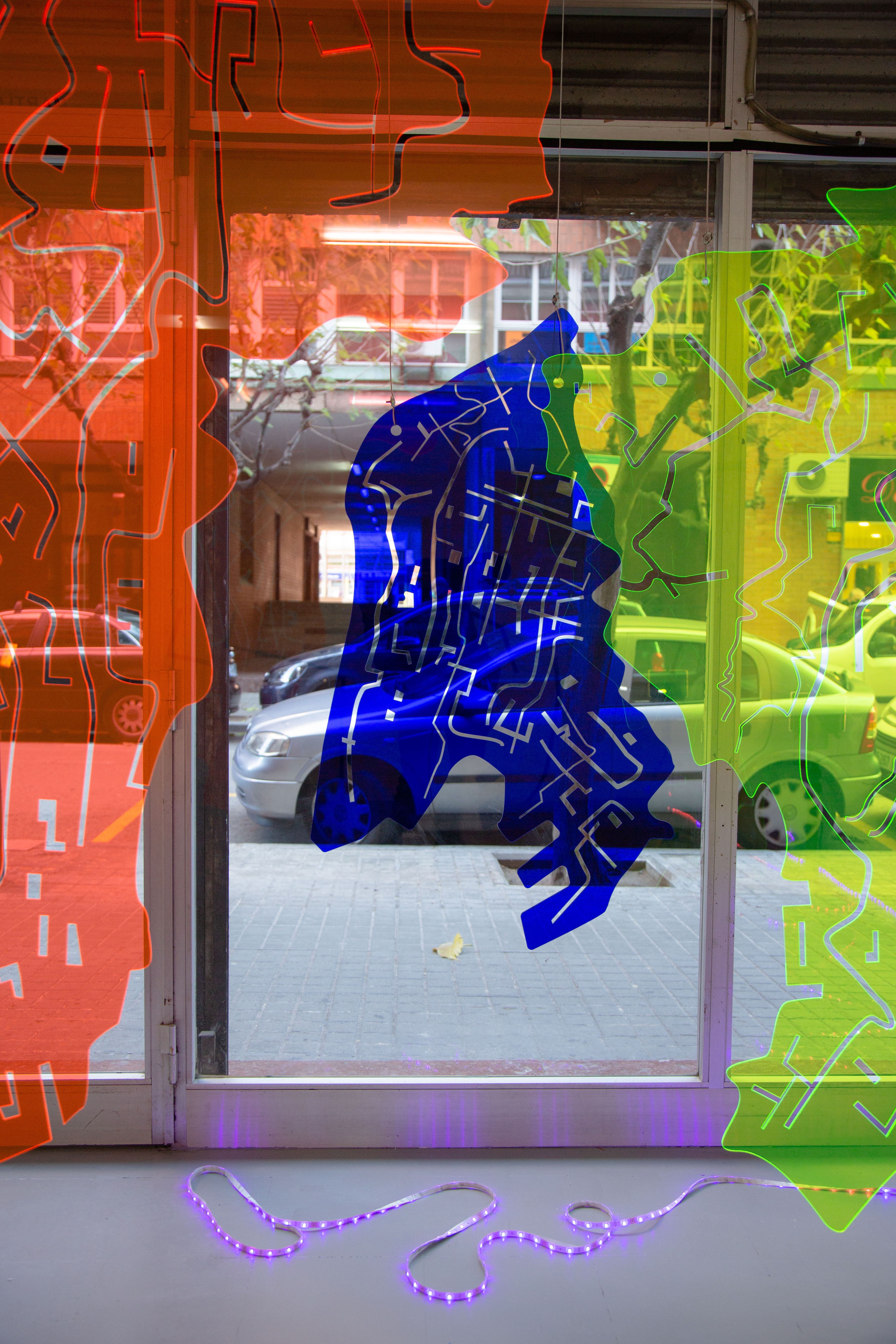
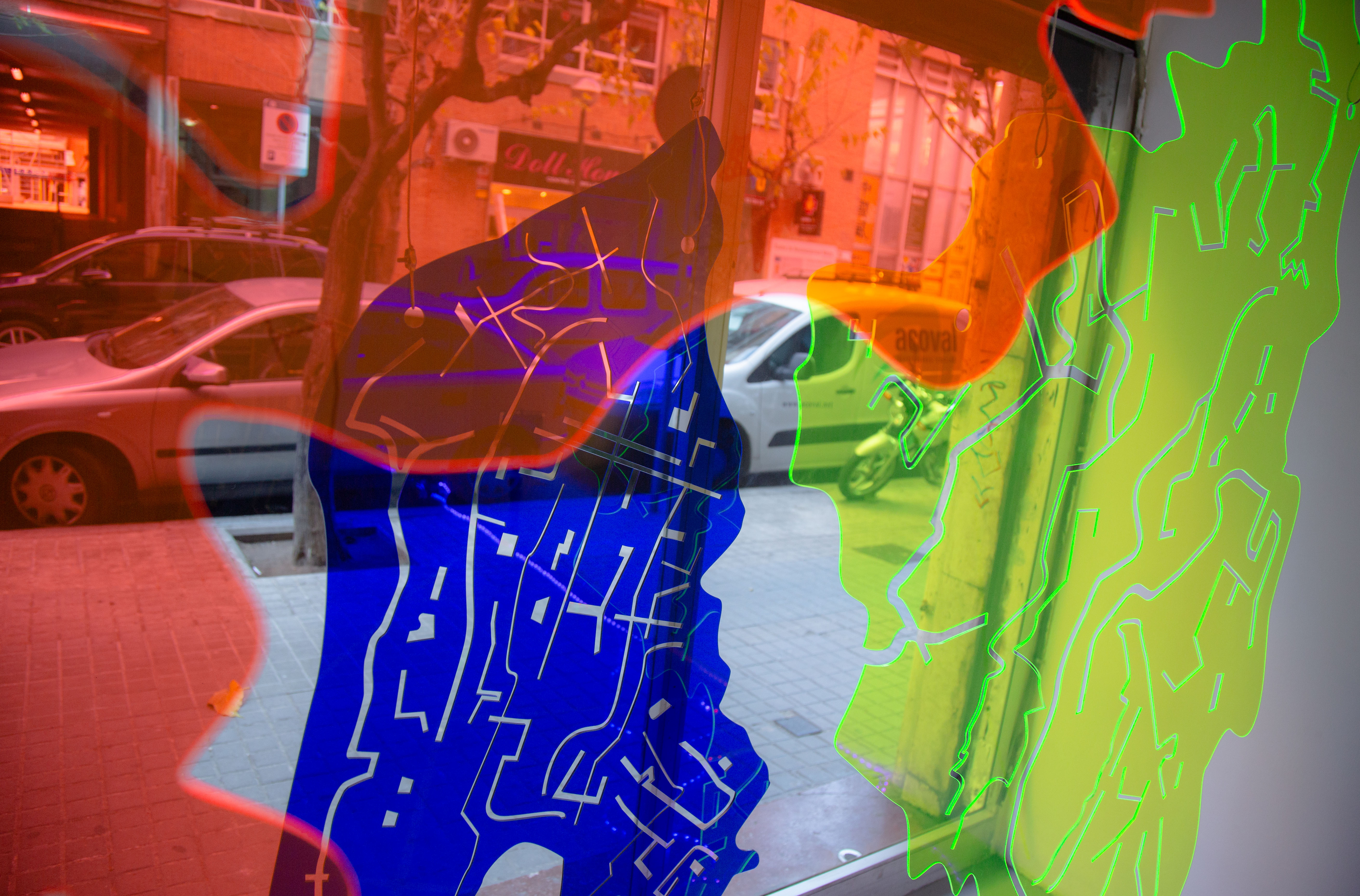
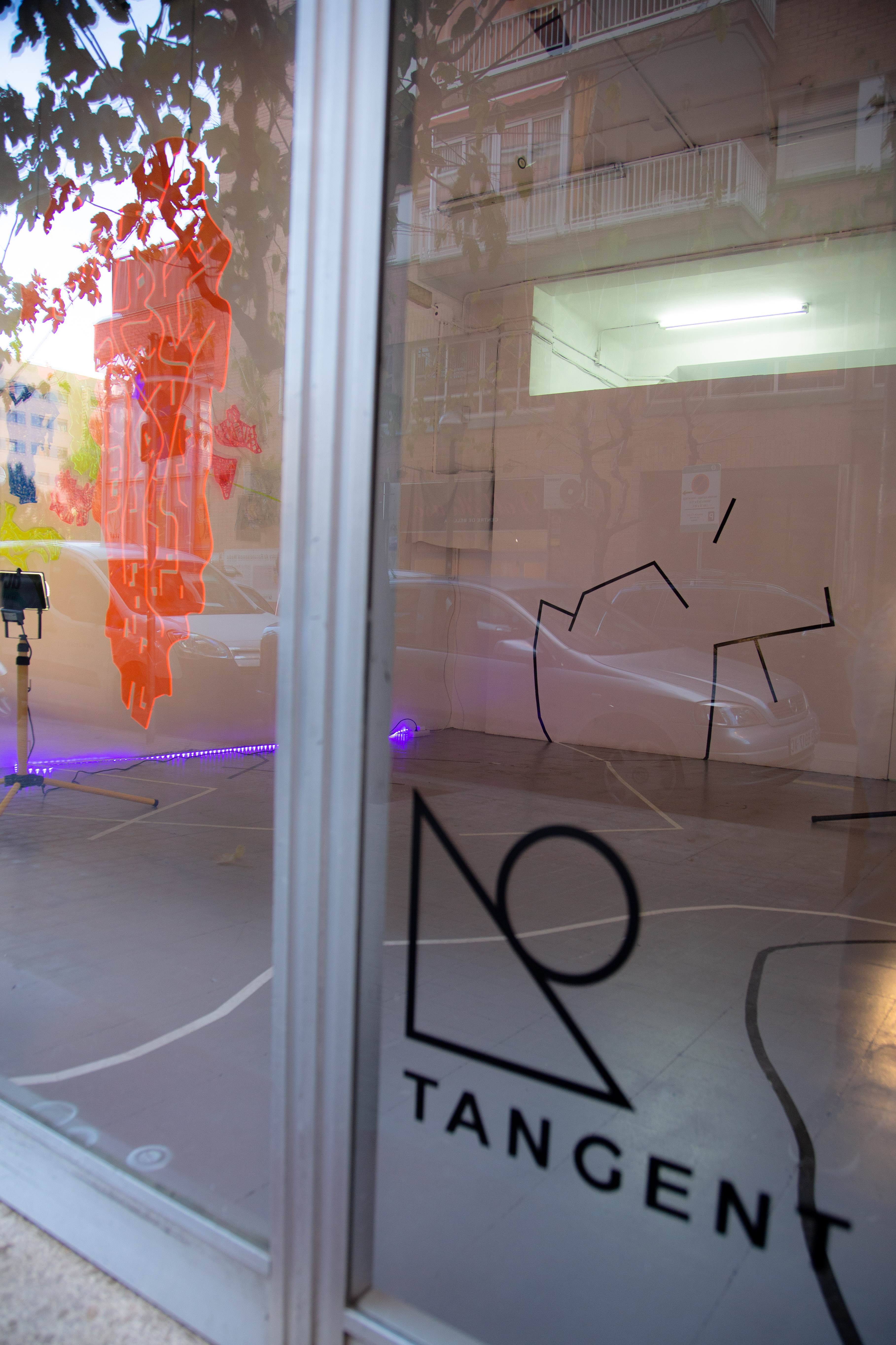
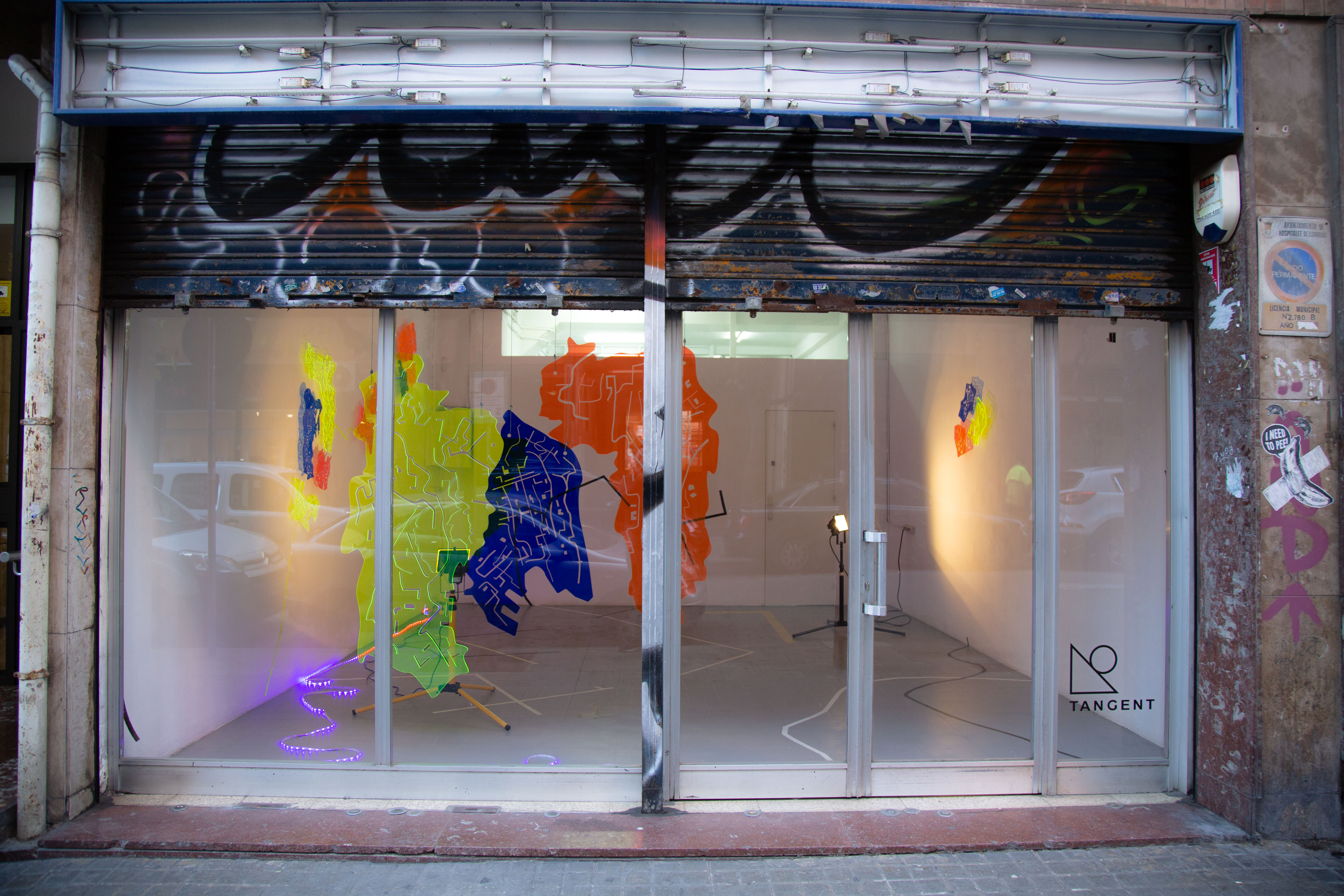
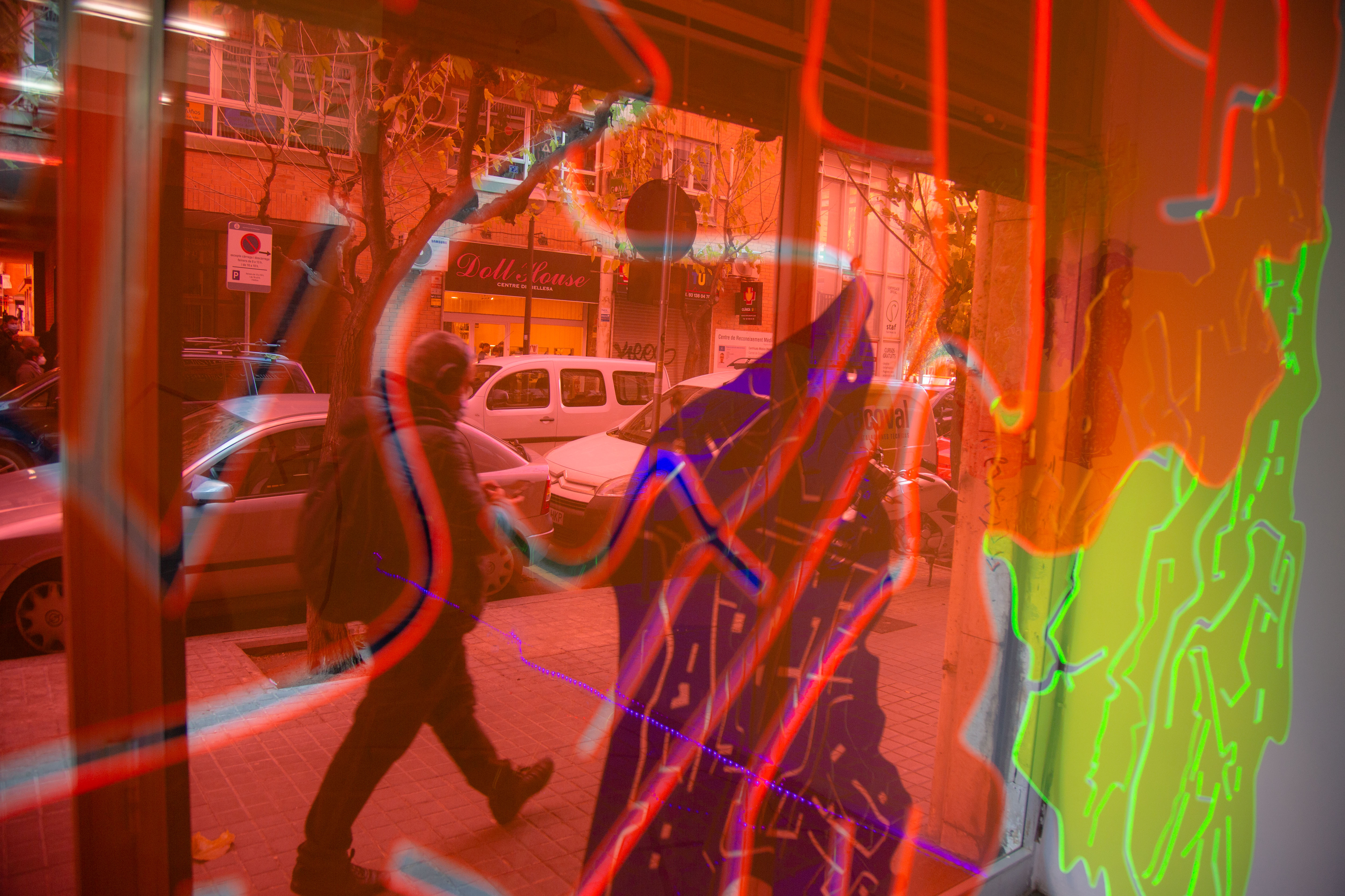
Natalia has created an atlas of possible world maps. Her intention is to generate a dissolution of territories and borders in order to replace them with imaginary divisions and dilated spaces – where the recognizable and utilitarian representation of the map disappears. Moreover, composing dystopian cartography, which leaves a mark, appropriates space and speculates between the imaginary – reality. she proposes a series of fragmented, fragile and sensitive territories, where the imaginary manifests itself as a position in which the state of instability, uncertainty and disorientation that we constantly fear can be extremely fruitful. Approaching us to a construction of micro-utopias that disarticulate that apocalyptic or sweetened vision of reality imposed by hegemonic power structures.
Imagination will act as an emancipatory impulse in order to delineate an antagonistic cartography. By suggesting new alternatives to re-conquer, re-invent and appropriate the territory, and subverting the current cartographic use of a biopolitical control mechanism towards a critical device and will claim action.
Top down – bottom up, is collection of material from over the last four years, linking different stages of experimentation that are connected and interwoven in an explorative process, from a subjective, intuitive, sensitive and feminine point of view. The material has been compiled into a site-specific installation at Tangent Projects gallery.
Public Art
CARTOGRAFÍA URBANA: CONQUISTA DE UNA GEOGRAFÍA GLOBAL
Cartografía urbana: Conquista de una Geografía Global, es un proyecto de investigación que propone mediante el uso de la lógica cartografica impulsar otras posibilidades para la gestión de proyectos de arte público en la práctica artística contemporánea.
Este proyecto pretende impulsar la reflexión crítica sobre las transformaciones que enfrenta el territorio a través de las políticas globales, mediante «el simulacro» , Jean Baudrillard, (Cultura y Simulacro), planteaba que la simulación de lo real, es suplantada por la representación de los signos de lo “real”, lo cual conducía hacia una hiperrealidad: entendida como estrategia de disuasión de lo real, la función del mapa como representación se cuestiona como método científico, pero a su vez ha posible subvertir su función hacia una imagen virtual que posibilitaba generar nuevas subjetividades y repensar el territorio.
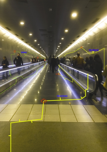
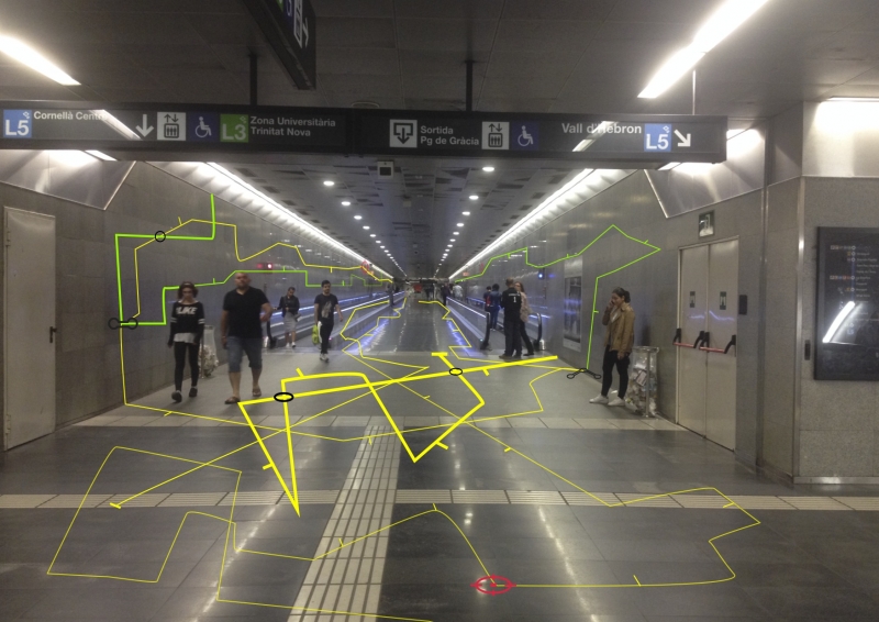
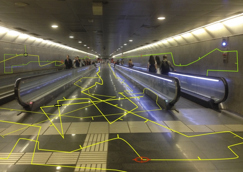
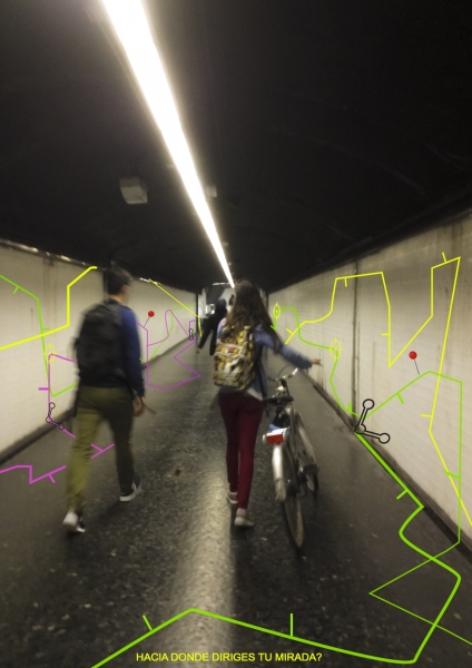
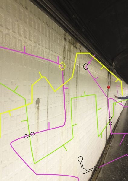
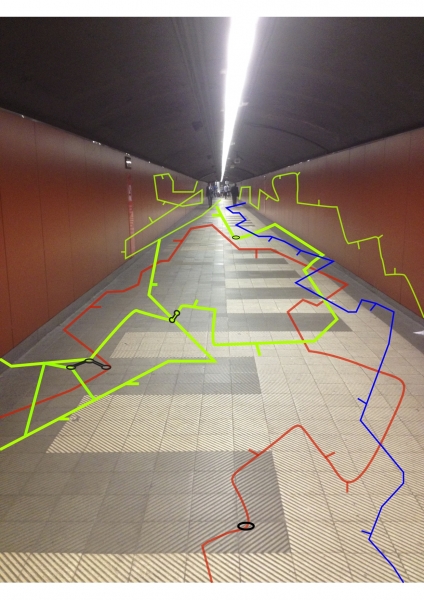
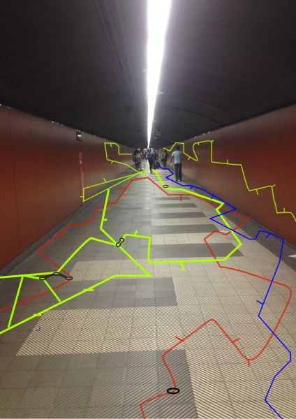
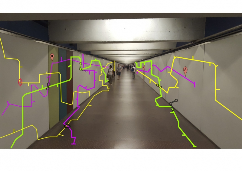
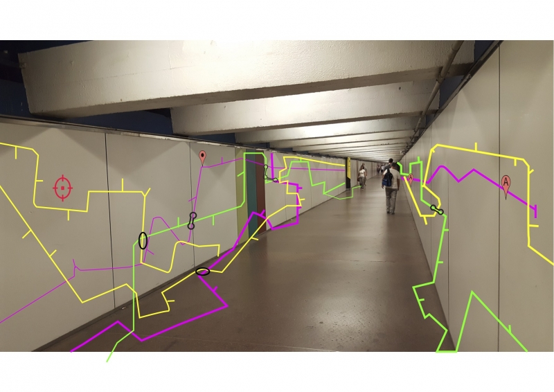
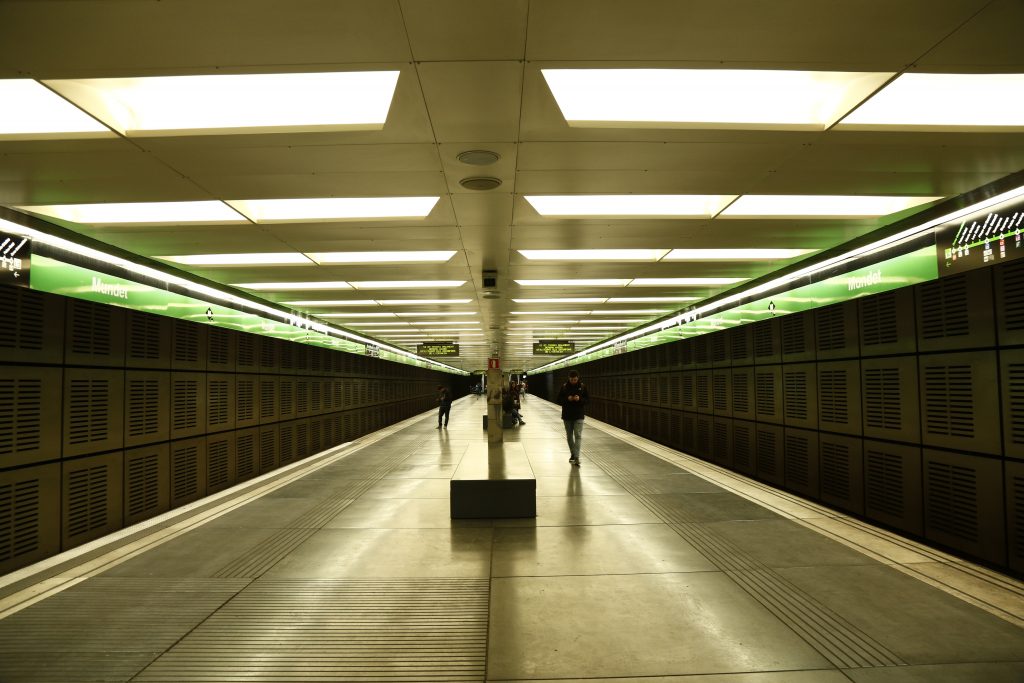
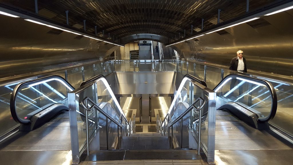
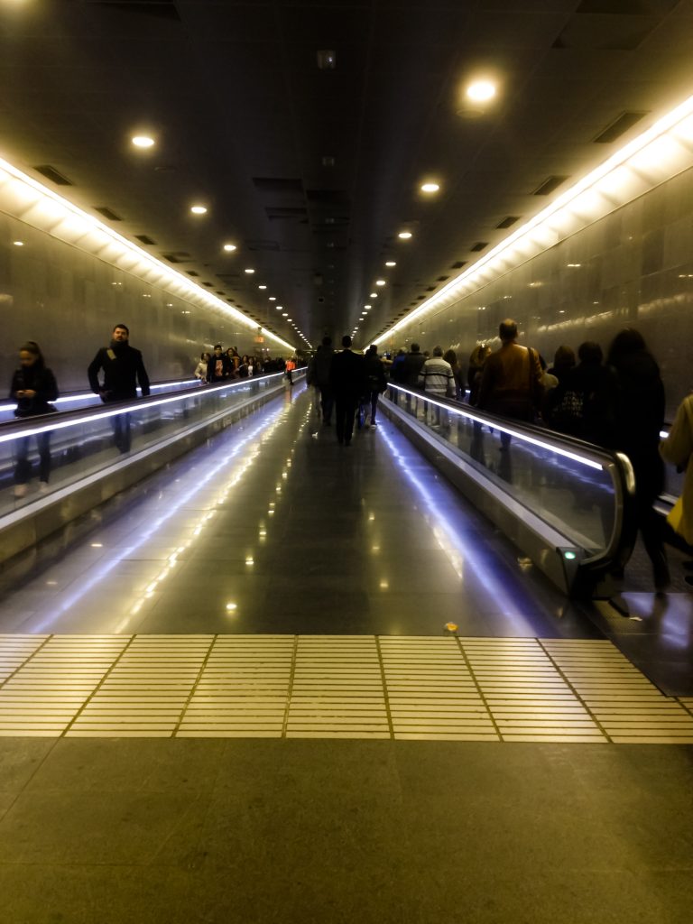
El cartografiado en este proyecto se plantea como un mecanismo de transformación crítica no institucionalizada de la esfera pública y urbana, en este caso el mapa se condesa en una propuesta de intervención en el espacio público. Planteamos un recorrido por algunas estaciones del metro en Barcelona, las cuales presentan largos recorridos y espacios disfuncionales, vigilados- inseguros, poco accesibles o bien son escaparates de publicidad o turismo, sin embargo los intereses económicos en estos espacios prevalecen ante una estructura precaria.
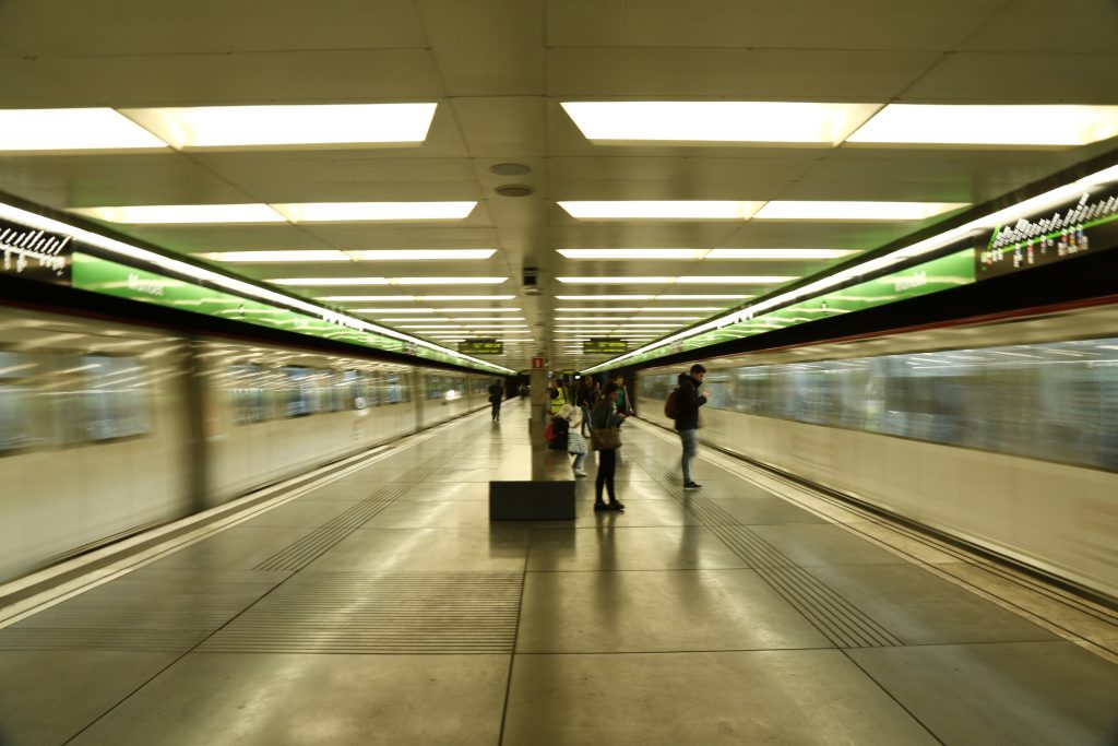
Se realizó un análisis de las estaciones de Sants, Paseo de Gracia, Universitat y Diagonal, en las cuales justamente se preveen según la unidad de mantenimiento del transporte metropolitano de Barcelona (TMB) .
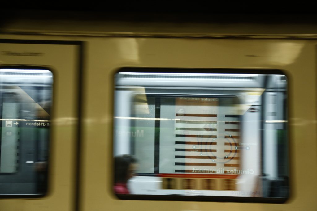
Hemos creado una gráfica a partir de la apropiación de la simbología, iconografía y señalización utilizada por parte del Transporte Metropolitano de Barcelona (TMB) y Google Maps, con el fin del contraponer lo “representado” con la “realidad” del “espacio público”, siendo en este caso la gráfica lo que llamamos el “mundo virtual”. Así mismo en estos territorios de transición y viaje la dependencia de dispositivos móviles de alguna manera imposibilitan la emancipación del “imaginario” o pensamiento crítico, debido a una enagenación colectiva con respecto a dependencia de dispositivos móviles, como consecuencia de los procesos globalizadores .

Esta propuesta se plantea como un proyecto experimental y de investigación, que se condensa en una contra cartografía, en la que se unen los puntos de un recorrido por aquellos espacios críticos, mediante el registro fotográfico y foto montaje.